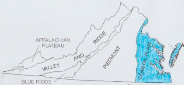
The Tidewater RegionThe Tidewater Region of Virginia is also called the Coastal Plain Region. It received its name because the major rivers that flow through the region rise and fall with the tide from the ocean. The Tidewater is the eastern most region of Virginia. It includes the land along the Chesapeake Bay and the Eastern Shore. It is located west of the Atlantic Ocean.
|
|
The LandThe Tidewater Region is an area of mostly low, flat land. It is located near the Atlantic Ocean and Chesapeake Bay. Several important bodies of water are located in this region, including the four major rivers, the Great Dismal Swamp, and Lake Drummond.
The Tidewater Region also includes the Eastern Shore and three other peninsulas; the Peninsula, the Middle Peninsula, and the Northern Neck. |
Products & IndustriesThe Tidewater Region produces many different products, or items produced to sell. The location near the water has provided a rich layer of soil, making the region a top producer of peanuts, cotton, and soybeans. The Atlantic Ocean also makes the Tidewater Region a top seafood producer.
The region's location near water also effects the many different industries. Shipbuilding, fishing/seafood, military bases, and tourism are important industries located within the Tidewater Region. Points of Interest
|
Smith, Karla. All Around Virginia Regions and Resources. Chicago: Heinemann Library, 2003. Print.
